TRAVEL EXPERIENCES IN LAI CHAU, VIETNAM
19-03-2019Beautiful nature and ethnic minorities
Formerly known as Tam Duong, this isolated town was renamed Lai Chau when the decision was made to flood ‘old’ Lai Chau (now Muong Lay). ‘New’ Lai Chau is split between the old town, with its market full of hill-tribe people, and the concrete new town 3km to the southeast.
Despite its grandiose streets and upgrade to provincial capital status, Lai Chau is still something of a one-horse town. Fortunately, the surrounding scenery of verdant conical peaks is as beguiling as ever.
Most visitors only dally long enough for a lunch break between Dien Bien Phu and Sapa. The drive from Lai Chau to Sapa along Hwy 4D, threading through the Fansipan Mountain Range near the Chinese border, is a beautiful stretch of road.
Lai Chau province has long been the poorest and least industrialized area in northern Vietnam. Lai Chau city is 450 km from the Hanoi and 70 km from Sapa. However, even here times are changing, and industry and the economy is growing gradually. Industrialproduction has almost tripled between 2000-2007, and agriculture and forestry grew by 50%.
Road infrastructure in Lai Chau is still lagging behind. But even that is slowly changing and plenty of roads are repaired or new ones built. The leading products are liquor, bricks, cement and electricity.
O Quy Ho:
O Quy Ho Pass is squeezed through Hoang Lien Son mountain range, at an altitude of 2000m. A legend in this mountain area: Once upon a time, here has a strange bird with melancholy cry, associated with the love legendary of a couple. Since then, over time, the cry "O Quy Ho" of this bird has been named for this wild pass.
Before, O Quy Ho Pass is very dangerous, and contains many horror stories that few people dare to cross this place. But now, the Pass with good upgrade, become a conduit for vehicles crossing more frequently. However, with a side of the abyss and the rest are usually steep cliffs, O Quy Ho Pass is still a challenge for the adventurous driving.

Tam Duong District
Tam Duong is a rural district of Lai Chau Province in the Northwest region of Vietnam. As of 2003 the district had a population of 41,235. The district covers an area of 758 km². The district capital lies at Tam Duong
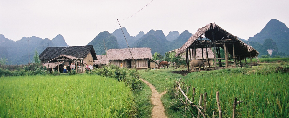
Muong Than rice field
"Number 1 Thanh, Number 2 Lo, Number 3 Than, Number 4 Tac" is the conclusion of ancestors talking about the most beautiful fields in the Northwest. Muong Than field in Than Uyen district is located on Highway 32 connecting Mu Cang Chai district with Lai Chau district.

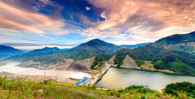
Lai Chau Hydropower
Lai Chau Hydropower is a national key project started construction in 2011 in Nam Hang commune, Muong Te district.
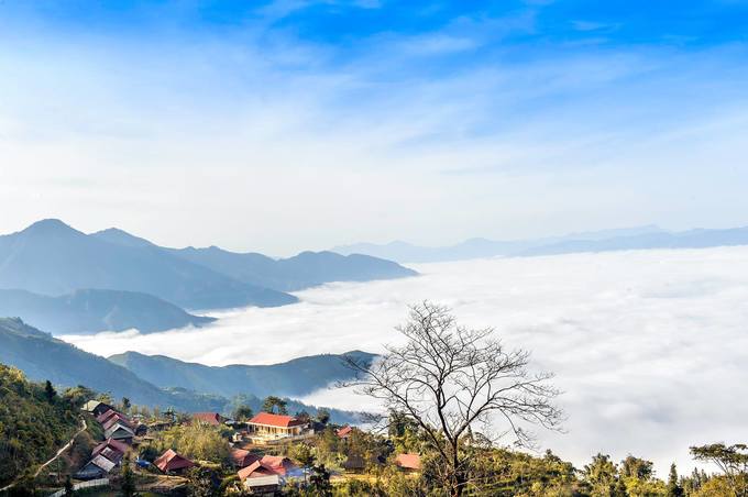
Sin Ho Plateau
Sin Ho Plateau is a potential tourist area of Lai Chau Province, as is the second Sapa of Vietnam. This place is in exotic nature with famous landmarks such as O mountain, Tien cave, there are some historical relics in Le Loi commune. Especially, Pao Dao village is located in Muong Lay Town (former Lai Chau Town, Dien Bien Town, now Dien Bien Province). It is 13 km long and is voted as one of the 5 attractive destinations by customers of a British travel agency. Most in Southeast Asia. However, the tourism activities here are still spontaneous, no products and objects clearly serve.



.jpg)
.jpg)
.jpg)
.jpg)
.jpg)
.jpg)
_.jpg)
.jpg)
.jpg)
.jpg)
.jpg)
.jpg)
.jpg)